By McKOY SCRIBNER
Capital News Service
LANSING — Although Great Lakes water levels are down, the risk of coastal erosion remains high, Michigan State University researchers say. Now, the researchers are enlisting “citizen scientists” to assist in helping better understand coastal change.
Funded by a $300,000 early concept grant from the National Science Foundation Coastlines and People Initiative, the Interdisciplinary Citizen-based Coastal REmote Sensing for Adaptive Management (IC-CREAM) project wants to work with multiple communities in the Great Lakes region facing impacts from record-high water levels.
The IC-CREAM team is developing a first-of-its kind citizen science program to equip and train volunteers to pilot drones and use other geospatial technologies to better monitor and understand coastal change and vulnerabilities.
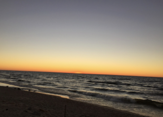
McLoy Scribner
Manistee Beach in 2014. A team of Michigan State University researchers is working with volunteers in coastal communities to track erosion in the state.The project, led by Assistant and Associate Professors Erin Bunting, Ethan Theuerkauf and Elizabeth Mack, aims to empower Michigan coastal communities to generate their own data on coastal changes and hazards by taking pictures of what is seen at beaches and uploading them to a web app.
“Take a picture with your phone. That photo has a geotag located, so all you have to do is upload that photo to the web app, and put in some information about like when it was collected, all that kind of stuff, and that helps us document it,” Theuerkauf said.
The team is working with citizen scientists to gather data in Marquette, Manistique, Iosco County, Chikaming Township, Manistee and South Haven.
Theuerkauf said getting scientists, citizens, and community decision-makers to work together is an important step in addressing coastal issues.
“We’re working hand in hand with those communities, we’re working hand in hand with the public, to provide information that we know is useful because we worked with them from the onset to decide what direction we need to take with this data collection and this processing.”
Planning is underway for additional proposals and partnerships with local, state and federal entities to expand project work and research.
This story is brought to you as part of a partnership between WKAR and Michigan State University’s Knight Center for Environmental Journalism.